 eAtlas Data Catalogue
ARC/INFO shapefile
Type of resources
Topics
Keywords
Contact for the resource
Provided by
Formats
Representation types
status
Scale
-
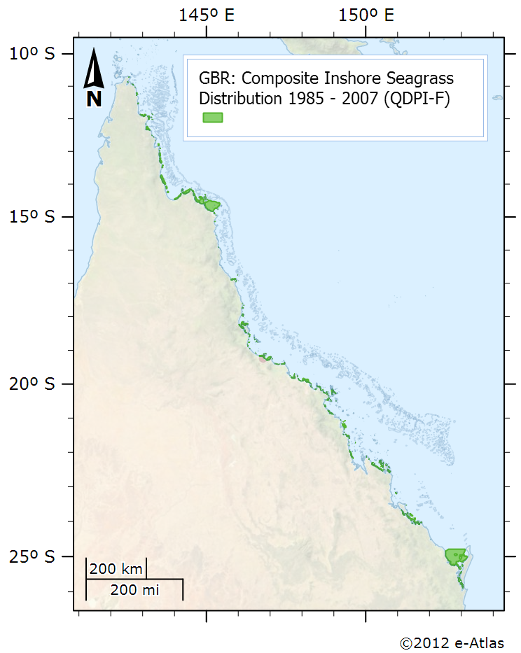
This dataset is shows the distribution of inshore seagrass along the eastern Queensland coastline. It is a composite of 38 surveys conducted from 1984 to 2007. Coastal seagrasses in waters shallower than -15 metres were mapped by dive surveys, under water cameras and inter-tidal aerial surveys. The data includes location information on the spatial extent of seagrass habitats mapped in 38 surveys between 1984 – 2007. The data does not include species information. Seagrass surveys were conducted at various times and at different precisions but the composite layer is the best depiction of seagrass for the GBRWHA and Hervey Bay presently available for planning purposes. Seagrass distribution can change seasonally and between years, and users should ensure that they make appropriate enquires to determine whether new or more appropriate information is available. Notes: This dataset is somewhat deprecated by a more recent compilation of seagrass data in 2015 that is openly available. See the related data link. Data Location: This dataset is filed in the eAtlas enduring data repository at: data\custodian\2006-2010-MTSRF\GBR_MTSRF-1-1-3_QDPI-F_Coles-R_Composite-seagrass-1984-2007